Ride On!
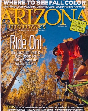
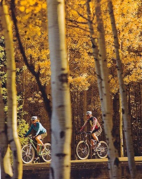
Fall is a season like no other for cyclists. The gust of cool air in your face, wheels churning through a forest floor carpeted in aspen leaves, serene silence punctuated by the shifting of gears, the startling beauty that arrives at the end of summer in a blaze of red, yellow and orange foliage.
It’s all right here in Arizona, a state that some mistakenly believe doesn’t have a change of seasons at all. But up in the high country, aspens are turning gold and maples, sumacs, oaks and sycamores are festooned in fall finery. Two-wheeler touring is the way to go—the entire experience brings a sense of intimacy with nature as you melt into the landscape versus blowing past it in an SUV traveling 65 miles per hour.
As Ernest Hemingway once wrote in an article for Collier’s, “You have no such accurate remembrance of a country you have driven through as you gain by riding a bicycle.” So join us on our unforgettable tour of Arizona fall cycling at its best.
Kaibab Plateau – North Rim Parkway
As one of Arizona’s most scenic stretches of road, designated a National Scenic Byway in 1998, this 42-mile trek begins at Jacob Lake and leads you through sweetly fragrant pine forests beneath a vault of turquoise sky, over grassy meadows and past groves of quaking aspen ablaze in golds, oranges and reds. This is the one of the few places in the world you might catch a glimpse of a Kaibab squirrel, a shy sprite known for tufts of long hair on its ears and a white plume as a tail. For the grand finale, the ride enters Grand Canyon National Park and ends at the historic stone-and-wood Grand Canyon Lodge with a terrace that invites weary cyclists to linger and look at sweeping panoramic views of the Grand Canyon. A short half-mile walk leads to Bright Angel Point (elevation 8,153 feet), an airy overlook of colorful buttes, spires, gargoyles, temples and ampitheaters.
Distance: 42 miles
Difficulty: Easy for experienced road cyclers, moderate for beginners
Getting There: From Flagstaff, take 89A to Jacob Lake
Accessibility: The road is accessible to all vehicles in fair weather.
Information: Kaibab National Forest, North Kaibab Ranger District, 928-643-7395 or www.fs.usda.gov/kaibab
San Francisco Peaks Segment of the Arizona Trail
If your bucket list includes trekking the nearly 800-mile Arizona Trail, be sure to catch the segment known as Passage #34 – San Francisco Peaks in the fall. Beyond golden aspen, it’s a Technicolor tour of gorgeous three-leaf sumac and box elders decked out in golds and reds. A sweeping 360-degree vista overlooks Humphreys Peak, the highest point in Arizona, Kendrick Peak hugging the horizon and the Nature Conservancy’s Hart Prairie Preserve below. Arizona Trail Director Shawn Redfield recommends the 12-mile cycling trek along smooth, rolling hills that begins at the Snowbowl parking lot and ends where the Arizona Trail intersects Forest Road 418. (To make the trek a 12-mile one-way journey, team up with a friend to park one car at the Snow Bowl parking lot and the other at the intersection of the Arizona Trail and Forest Road 418.) For specific details on the route, visit the Arizona Trail Association at www.aztrail.org/passages/pass_34.html.
Distance: 12 miles
Difficulty: Intermediate skills to maneuver over rolling hills and a section that climbs steeply, gaining an elevation of 1,400 feet over four miles
Getting There: From Flagstaff, drive northwest on Highway 180 (just past mile marker 222), turn north on Snowbowl Road and continue another 7 miles.
Accessibility: The road is accessible to all vehicles in fair weather.
Information: Coconino National Forest, Flagstaff Ranger District, 928-526-0866 or www.fs.usda.gov/recarea/coconino/recarea/?recid=70983
Flagstaff Urban Trail System
Nothing heralds Flagstaff’s status as a cycling stronghold quite like the fact that you can pedal 50 miles on trails that crisscross the city at its most scenic spots and never leave town. Up until now, you may have tried to find contentment with life in the bike lane—road outings spent hugging the white lane as SUVs rocket past. If so, you’ll fall head over wheels in the love with Flagstaff’s Urban Trail System (FUTS), a city-wide network of non-motorized pathways ideal for two-wheel touring. While looking for Flagstaff’s chief “spokes” person, we caught up with Martin Ince, the city’s multi-modal transportation planner, to find out what are his top FUTS picks for fall color. His fall faves include the 2-mile Buffalo Park Loop, an expansive mesa atop an ancient lava flow that’s mainly open, native grasslands with a panoramic view of the San Francisco Peaks. A perfect crisp fall day also can be spent pedaling the 5.7-mile Sinclair Wash Trail that travels north from Fort Tuthill County Park, through a rural area of open grasslands and ponderosa pines, enters the campus of Northern Arizona University and parallels Rio de Flag through a verdant limestone-walled canyon. Leaf peepers also won’t want to miss the 3.6-mile Karen Cooper Trail that begins at Wheeler Park in downtown Flagstaff and wends past willow-lined riparian wetlands, stands of mature ponderosa pines and oak thickets.
Distance: Trail lengths vary
Difficulty: Easy
Getting There: From Phoenix, drive north on Interstate 17 approximately 150 miles to Flagstaff
Accessibility: The road is accessible to all vehicles in fair weather.
Information: City of Flagstaff, 928-774-5281 or www.flagstaff.az.gov/index.aspx?nid=1379
Icehouse Trail in Globe
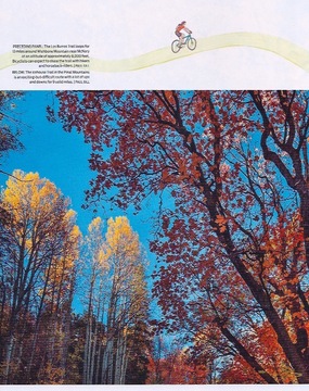
Unless you’re a highly skilled and experienced mountain biker, Icehouse Trail should be classified as “don’t-even-think-about-it.” But for the adventurous few who’ve already gained a Zen-like mastery over their mountain bike through the school of hard knocks (and cracked ribs), this ride can be like a roller coaster ride that makes grownups (in helmets and full body protection, of course) want to shout like a kid, “Let’s do it again!” On a trail full of twists and turns, the trek goes from desert scrub in lower elevations through colorful stands of maples, sumac, walnut and aspen at higher elevations. But as Paul Burghard, recreation specialist with the Tonto National Forest Globe Ranger District, points out, you might be too busy desperately trying to hang on to your handlebars to even notice.
Distance: 9 miles roundtrip
Difficulty: Requires highly advanced mountain biking skills
Getting There: From Globe, follow the signs to the Besh-Ba-Gowah
Archaeological Park. Just past the turnoff to the park, turn right onto Icehouse Canyon Road (Forest Road 112) and go 1.7 miles to a stop sign. Continue straight for 2.5 miles, then turn left at the sign to Trails 197 and 192 and go about a quarter-mile to the Icehouse CCC Recreation Site.
Accessibility: The road is accessible to all vehicles in fair weather.
Information: Tonto National Forest, Globe Ranger District, 928-402-6200 or www.fs.usda.gov/tonto
Patagonia-Sonoita Scenic Byway
Along the State Route 83 scenic byway that begins about 20 miles east of Tucson and ends in the old ranch town of Sonoita, great swaths of long grasses ripple in the breeze and windmills pivot lazily along the hillsides of this cattle country, home to two of the largest ranches in the West’s history, the family-owned San Ignacio de Babacomari land grant and the legendary Empire Ranch, which was established in the 1860s and grew to more than a million acres by the turn of the century. Saturated with the atmosphere of the Old West, the Sonoita grasslands have lent authenticity to movies that run the gamut from “Oklahoma!” and “Red River” to “Tin Cup” and “Young Guns.” At an altitude of over 4,000 feet, the surrounding rich red soil—combined with warm, sunny days and cool nights—provide conditions agreeable to wine grapes, making the Sonoita-Elgin area Arizona’s wine country. For a glimpse of fall color venture farther to Patagonia, where the cottonwoods along the San Pedro River burst in yellows and oranges once the crisp autumn air settles in.
Distance: 27 miles
Difficulty: Easy for experienced road cyclers, moderate for beginners
Getting There: From Tucson, travel southeast on Interstate 10 to Exit 281, which connects to State Route 83
Accessibility: The road is accessible to all vehicles in fair weather.
Information: The Sonoita/Elgin Chamber of Commerce, 520-455-5498 or www.sonoitaelginchamber.org
Grant Hill Loop Trail, Coronado National Forest
For more adventurous types who seek their fall color fix by riding through woods, negotiating twists and turns and roots and rocks, it’s good to know both the Grant Hill Loop Trail and adjoining Cunningham Loop Trail in the Pinaleño Mountains near Safford were both designed with the mountain biker in mind. The trails consist of a collection of old logging roads along with new paths constructed to create a network of loops that wind through a mixed conifer forest of Douglas-fir, white fir, Engelmann spruce with groves of aspen, whose brilliant gold and orange leaves flutter in the slightest breeze. At an elevation over 9,000 feet, the end of the first (eastern most) logging road offers a sweeping vista of Sulphur Springs Valley, Fort Grant and the Galiuro Mountains. Take your pick—if you’re seeking a greater mountain biking challenge, ride Grant Loop Trail in a counterclockwise direction or take it easier by traveling clockwise. You also have the option of venturing down the adjoining Cunningham Loop Trail, which crosses a few small drainages as well as Grant Creek, and adding an overnight camping stay at the nearby Hospital Flat Campground.
Distance: 5.9 miles for Grant Hill Loop Trail and 5.6 miles for Cunningham Loop Trail
Difficulty: More difficult
Getting There: From Safford drive south 8 miles on US 191 to AZ 366 (the Swift Trail). Turn right (southwest) onto AZ 366 and drive 23.5 miles beyond the Hospital Flat Campground to the Grant Hill Loop trailhead.
Accessibility: The road is accessible to all vehicles in fair weather.
Information: Coronado National Forest Safford Ranger District, 602-428-4150 or www.fs.usda.gov/coronado
Prescott’s Scenic Trails
Idyllic weather, fluffy cumulus clouds floating lazily in a brilliant cerulean blue sky overhead, the calming scent of Ponderosa pine hanging heavily in the air, a cool breeze that rustles leaves and nudges you down the trail ahead like an encouraging friend. Fall is a glorious season that invites you to explore Prescott’s scenic beauty from the saddle of a bike, along smooth and meandering paths such as the Granite Basin Recreation Area’s West Lake Trail (#351), which leads past scattered stands of piñon pine, jumbles of granite boulders and alligator juniper with Granite Mountain looming on the horizon. Travel clockwise for an easier ride, or counterclockwise if you’d like to increase your pedal power. The easy single-track trail measuring less than 2 miles connects with the Balancing Rock Trail (#349) that overlooks panoramic, picture postcard views of Granite Mountain and the surrounding wilderness. Both trails are popular for equestrians, so mountain bikers are encouraged to exercise caution and avoid wearing headphones that can hinder awareness of the surroundings. For experienced mountain bikers looking for more of a technical challenge, the 3.4-mile combo of Pine Lakes Trail (#316) and Ridgetop Trail (#317) features steeper sections and rocks embedded in the trail. If traveled clockwise, the loop features expansive views of the San Francisco Peaks and Thumb Butte.
Granite Basin Recreation Area
Distance: West Lake Trail (#351) is 1.5 miles. Balancing Rock Trail (#349) is 3.2 miles
Difficulty: Easy to moderate
Getting There: From its intersection with Willow Creek Road, travel northwest on Iron Springs Road for 3 miles. Turn right onto Granite Basin Road and proceed 2.4 miles to the Cayuse Equestrian Trailhead on the right. Continue 0.1 miles to the parking area.
Accessibility: The road is accessible to all vehicles in fair weather.
Information: Prescott National Forest, 928-443-8001 or www.fs.usda.gov/prescott Pine Lakes Trail (#316) and Ridgetop Trail (#317)
Distance: 3.4 miles combined distance
Difficulty: Moderate for experienced mountain bikers, difficult for beginners
Getting There: From downtown Prescott, travel west on Gurley Street (becomes Thumb Butte Road) for 3.4 miles to Thumb Butte Picnic Area, on the right.
Accessibility: The road is accessible to all vehicles in fair weather.
Information: Prescott National Forest, 928-443-8001 or www.fs.usda.gov/prescott
Hart Prairie Road in Flagstaff
For more dazzle for the dollar, forget booking a cross-country flight to Vermont for a “leaf-peeping” bicycle tour. Instead, you can turn the annual event into a single-day call-in-sick trek along a 10-mile scenic stretch of Hart Prairie Road (Forest Road 151) in Flagstaff. After you mount your bicycle approximately 10 miles north of town, just off U.S. Route 180, and pedal a mile to where the dirt road crests a hill, you’ll enjoy your first glimpse of the leaf Lollapalooza to come — a stand of aspens with quivering leaves aglow like liquid sun in a sea of forest green pines. Pedal another half mile and you’ll encounter the breathtaking view of the San Francisco Peaks towering high above mountain meadows, flanked by golden plumes of aspens. Keep going with the glow and you’ll soon be surrounded by a meadow frequented by herds of elk and deer and later you’ll pedal past an idyllic log cabin that looks cozy and inviting on this snuggly-sweater cool day.
Distance: 10 miles one way
Difficulty: Easy to moderate, depending on skill level
Getting There: From Flagstaff, drive west on U.S. Route 180 for approximately 10 miles and turn right onto Hart Prairie Road (Forest Road 151), which is just before Mile Marker 226.
Accessibility: The road is accessible to all vehicles in fair weather.
Information: Flagstaff Ranger District, 928-774-1147
Los Burros Trail in McNary
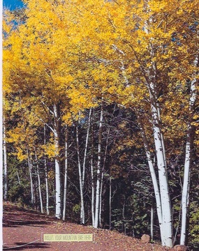
To follow the foliage, head to Arizona’s high country, the 2,000-square-mile swath of the state known as the White Mountains, where you’re sure to discover gold—aspens, that is. Stands of white-trunked quavering aspens, leaves ablaze in golds and oranges, offer a colorful contrast to towering spruce, pine and fir that line the 13-mile Los Burros Trail that loops around Wishbone Mountain near McNary. Beyond fall foliage at its finest, the ride also offers chance encounters with elk, mule and the occasional black bear.
Distance: 13 miles
Difficulty: Moderate
Getting There: From McNary, turn left on Forest Road 224 and follow the signs to Vernon. Drive approximately 8 miles until road signs direct you to turn right into Los Burros Campground. Drive to the far end of the campground to find the trailhead.
Accessibility: The road is accessible to all vehicles in fair weather.
Information: Apache-Sitgreaves National Forests, 928-333-4301 or www.fs.usda.gov/asnf