Brochure
The Juan Bautista de Anza
National Historic Trail in Arizona
Anza charted the route, carved through bone-dry deserts and mountain passes, during his first exploratory expedition in 1774, an adventure historians compare to the famed Lewis and Clark Expedition. Not only did he succeed in finding a safe and predictable route to San Francisco, but he forged friendly ties with the Yuma tribe at the confluence of the Gila and Colorado rivers—a relationship that would prove invaluable in the 1775 colonizing expedition.
Today, we can join Anza and the settlers on their epic journey, retracing their footsteps along the route now memorialized as the Juan Bautista de Anza National Historic Trail. Whether you choose to experience Arizona’s section of the trail from the front seat of your car, on horseback, aboard a bicycle, or by foot, here’s your guide to some of the most striking historic landmarks and vistas along the way.
Yuma
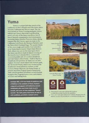
Yuma is a unique hub that stands at the confluence of the Colorado and Gila rivers, where Arizona, California and Mexico meet. The city once known as Yuma Crossing enchants visitors with its epic history that rivals a spellbinding novel, not only of the Anza expedition, but of famed Spanish conquistadors and missionaries, including Father Eusebio Francisco Kino; daring trappers like Kit Carson, ‘49ers en route to the California Gold Rush, the Mormon Battalion and the Butterfield Overland Stage. The quaint charm of this once rough-and-tumble river town lives on at Yuma Quartermaster Depot State Historic Park, where you can see the exact spot where the Anza expedition made its famed crossing of the treacherous Colorado River, examine the recovered paddle axle of a sunken steamboat and visit Yuma’s oldest home built in 1859 by a steamboat entrepreneur. Here, you can explore Arizona’s most visited state historic park, the Territorial Prison, which once locked up the Southwest’s most notorious outlaws, or the Century House Museum, the former home of pioneer merchant Eugene Francis Sanguinetti, with colorful gardens of brilliant red and fuchsia bougainvillea, fragrant lemon trees and aviaries of exotic and talking birds.
Antelope Hill, a 575-foot knob of sandstone east of Wellton in the outskirts of Yuma, features enigmatic petroglyphs left behind by ancient inhabitants who used stone tools to peck, scratch and carve art into sandstone. “Desert varnish,” the dark patina that forms on rock in arid conditions, provided a natural canvas.
Phoenix
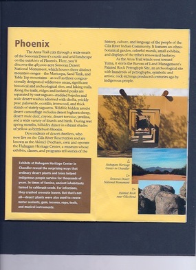
The Anza Trail cuts through a wide swath of the Sonoran Desert’s exotic and arid landscape on the outskirts of Phoenix. Here, you’ll discover the 487,000-acre Sonoran Desert National Monument, which houses three distinct mountain ranges—the Maricopa, Sand Tank, and Table Top mountains—as well as three congressionally designated wilderness areas, significant historical and archeological sites and hiking trails. Along the trails long ridges and isolated peaks are separated by vast saguaro-studded bajadas and wide desert washes adorned with cholla, prickly pear, paloverde, ocotillo, ironwood, and thick stands of stately saguaros. Wildlife hiding amidst desert camouflage includes desert bighorn sheep, desert mule deer, coyote, desert tortoise, javelina, and a wide variety of lizards and birds.


Descendents of desert dwellers, who now live on the Gila River Reservation and are known as the Akimel O’odham, own and operate the Huhugam Heritage Center, a museum whose exhibitions, classes, and programs tell stories of the history, culture, and language of the people of the Gila River Indian Community. It features an ethnobotanical garden, colorful murals, small exhibits, and displays of the tribe’s renowned basketry.
As the Anza Trail wends west toward Yuma, it skirts the Bureau of Land Management’s Painted Rock Petroglyph Site, an archaeological site with hundreds of petroglyphs, symbolic and artistic rock etchings produced centuries ago by prehistoric people.
Exhibits at Huhugam Heritage Center in Chandler reveal the surprising ways that ordinary desert plants and trees helped indigenous people survive for thousands of years. In times of famine, ancient inhabitants turned to saltbrush seeds. For infections, they crushed creosote leaves. But that’s not all—desert plants were also used to create water sealants, gum, incense, rope, tools and musical instruments.
Tucson & Casa Grande
One leg of the Anza adventure brings visitors to Tucson and its outskirts, with a stop at the famed “white dove of the desert,” Mission San Xavier del Bac. With a white dome and tower framed by a weathered adobe archway beneath cerulean blue skies, San Xavier blends elements of the old and new worlds. Beyond the mission, other scenic stops along the Anza Trail include the breathtaking, panoramic views offered by Sentinel Peak or “A” Mountain; the Santa Cruz River Park and Saguaro National Park.
About 35 miles northwest of Saguaro National Park, Picacho Peak State Park hosts Civil War re-enactments that commemorate April 15, 1862, the fateful day the westernmost battle of the Civil War was fought. Trails wind up the landmark 1,500-foot Picacho Peak, offering views of seas of wildflowers that often bloom in spring. Further north, the enigmatic Casa Grande (or “great house”) Ruins National Monument holds the secrets of an ancient—yet advanced—civilization that ingeniously built miles of canals across the arid desert.
Although Saguaro National Park is named for a cactus that exists nowhere else in the world and is an iconic symbol of the Wild West, the park surprises visitors by its lush vegetation—carpets of spring wildflowers, cascading waterfalls, aspens and Douglas firs—and one-of-a-kind critters—from kangaroo rats to the elusive elf owl.
Nogales & Tubac
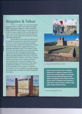
Visitors to Nogales can retrace the famed migratory path or trade route called El Camino Real (“The King’s Highway”) while reliving the town’s Wild West past at historic landmarks such as the neoclassic 1904 Courthouse that stands on a hill overlooking Main Street and the Old City Hall, built in 1914, which now houses the Pimería Alta Historical Society.
Just 18 miles to the north, the battered yet beautiful towering adobe walls and burnt adobe bell tower of famous Jesuit missionary Father Eusebio Francisco Kino’s first mission in Arizona, San José de Tumacácori, capture the history of Spanish missionaries in the “New World.” From here, you can venture down a 4.5-mile trail along the Santa Cruz River through a lush riparian habitat of cottonwoods and mesquite leading to Tubac, the oldest Spanish settlement in the state. Beyond the adobe remnants of the Tubac Presidio, built in 1752 to protect the nearby Tumacácori mission and settlers, the surrounding 12-acre state park includes a museum, one of the oldest territorial schoolhouses, and the hand press used to print the first newspaper in Arizona. A re-enactment of the expedition’s passage through Tubac takes place annually in October during the Anza Days.
Father Eusebio Francisco Kino established Tumacácori as a mission in January 1691 to convert the local Pima Indians to Christianity. Today, Tumacácori National Historical Park offers a rare glimpse of how Indians built this mission church, unfinished and abandoned in 1848, where a nave and altar in simple, rough adobe display humble devotion.
Arizona’s West Coast
Not only did the mighty Colorado River sculpt the Grand Canyon, but it also forged Arizona’s west coast, spinning a green ribbon of lush cottonwood-willow forests, cattail wetlands and lagoons laced through arid desert mountains. Back in 1949 pioneer conservationist Aldo Leopold unveiled the beauty and splendor of this region in his “A Sand County Almanac.”
Dams have since shackled the once-mighty Colorado River, but its natural grandeur remains along hiking trails at Cattail Cove State Park and Buckskin Mountain State Park. Cattail Cove State Park’s Whytes Retreat Trail, a 1 ½-mile easy hike, follows Lake Havasu’s shimmering shoreline while overlooking the lower portion of the Colorado River and Parker Dam. For another glimpse of the river known as the “American Nile,” trek along Buckskin Mountain State Park’s Lightning Bolt Trail, a 3-mile loop that heads into the Buckskin Mountains and commands views of cottonwood-willow stands, reed and cattail lining the river. Overhead, osprey, merlin and brown and white pelican skim the sky, while an occasional white egret stands like a statue near the shore.
Grand Canyon by the Numbers
2,000 million—the age of the oldest rocks at the bottom of the Grand Canyon
6 million—the approximate age of the Canyon, incised by the mighty Colorado River
5 million—the number of visitors who journey to the Grand Canyon each year (most of them view the Canyon at car overlooks along the South Rim)
1,218,375—the number of acres encompassed by Grand Canyon National Park
6,000 feet—the depth of the Grand Canyon at its deepest point. It spans 15 miles at its widest, and its length is 277 river miles, beginning at Lees Ferry and ending at Grand Wash Cliffs.
More than 1,500—the number of plant species that can be found in the canyon, along with 355 types of birds, 89 different mammals, 47 species of reptiles, 9 types of amphibians and 17 different fish species.
Five out of seven—the number of life zones in the Grand Canyon (Lower Sonoran, Upper Sonoran, Transition, Canadian and Hudsonian). This is the equivalent of driving from Mexico to Canada.